
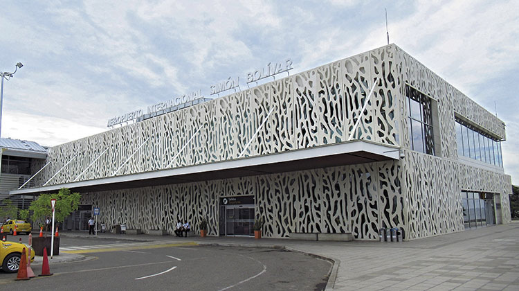
Simón Bolívar International Airport is situated in the far north of the Republic of Colombia, 16.5 kilometres from the city of Santa Marta, capital of the department of Magdalena. The region’s main tourist attractions include the Sierra Nevada de Santa Marta mountain range, Tayrona National Park and the cities of Barranquilla and Cartagena, two of the country’s most important conurbations.
Opened some 60 years ago, in recent decades tourism and economic development in the region have caused airport traffic (primarily of domestic origin) to grow from 532,000 passengers in 2009 to 2.4 million in 2019, with a compound annual growth rate of 16.5%. To accommodate this growth, the airport was modernised in 2017 with new facilities such as a control tower, passenger terminal and car park.
In recent decades, tourism and economic development in the region have driven growth in airport traffic, with 2.4 million passengers in 2019
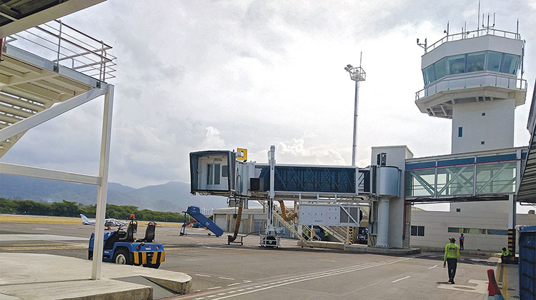
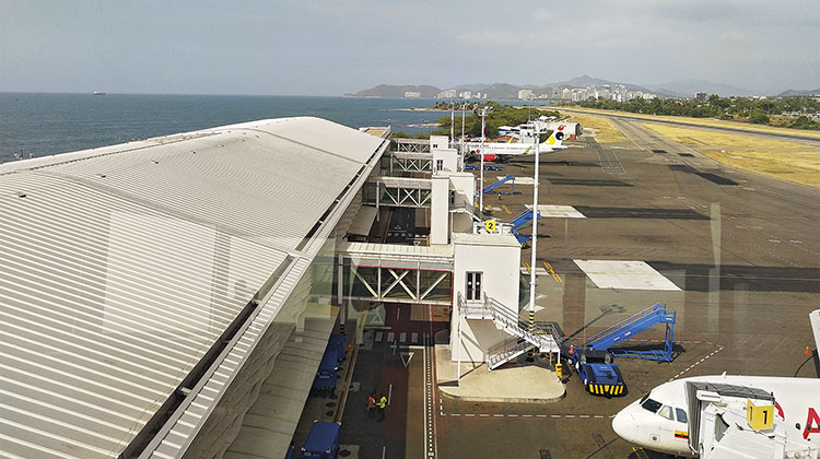
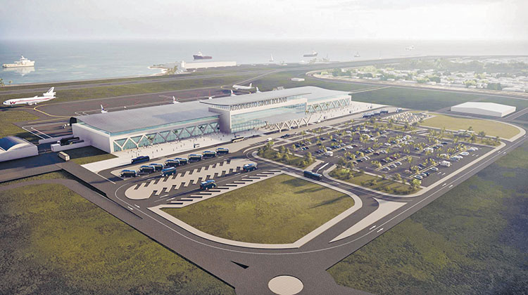
At present, the airport has one runway (01/19), which is 1,700 metres long by 40 metres wide and accessed via two taxiways. There is an apron with six stands for parking commercial aircraft, two general-purpose aviation hangars, and a helicopter pad. The three-storey terminal building covers an area of 14,600 m2. There is also an underground car park for cars and motorcycles, and a surface-level car park for taxis and buses. Road access is via the Troncal del Caribe, one of the country’s most important trunk roads.
Despite these improvements, the investments that have been made in the Magdalena region to boost tourism mean that a growth in international traffic is expected over the coming years. This is reflected in the traffic forecasts in the Master Plan drawn up by the UTE APM Simón Bolívar consortium, which is led by Ineco and also includes the Spanish engineering firm Ivicsa. The Plan was approved by Colombia’s civil aviation authority, Aerocivil, in December 2020.
Future plans
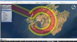
The Master Plan is the centrepiece of the planning process for an airport. It sets out the path for development and growth based on different traffic forecasts. Taking the current situation as the starting point, a study is made of potential demand in different time horizons. The aim is to determine what infrastructure and services will be required, in accordance with international safety and quality standards, and when they will be required, along with an estimate of costs.
The Plan also evaluates the impact of the airport’s activities on its surroundings and coordinates actions with the aviation authorities, the local community, and local and regional administrations and public bodies. The final stage is approval of the Plan on the part of the state aviation authority (Aerocivil in the case of Colombia). In order to meet these objectives successfully, a Master Plan must be updated periodically, and whenever changes in demand require it to be modified.
Ineco has over 20 years of experience in the drafting and updating of Master Plans: not only for the Aena network of Spanish airports, but also for countries such as Mexico and Kuwait.
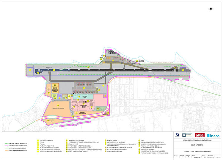
PROPOSED DEVELOPMENTS. Summary of the developments proposed by the Master Plan, in comparison with the airport’s current boundaries (marked in green). PLAN_UTE APM SIMÓN BOLÍVAR
The first step: predicting the evolution of traffic
In order to draw up the Master Plan, Ineco’s airport experts began by generating short, medium and long-term traffic forecasts for Simón Bolívar Airport, taking into account factors such as the anticipated growth in international tourism. After an exhaustive analysis they defined a number of different traffic horizons: in the short term, a volume of 3.5 million passengers, with 27,400 aircraft movements; in the medium term, 4.5 million passengers, with 35,000 movements; and in the long term, 7.3 million passengers with over 52,000 movements. In light of the investments made in recent years to promote tourism in the Magdalena region, it was estimated that almost 5% of this traffic could be international.
After preparing the traffic forecast, the experts then identified the needs of the existing infrastructure. They found that the length of the existing runway limited the potential for flights to international destinations in the region, and that it would therefore be necessary to extend it. They also concluded that both the terminal and apron were close to saturation; however, the airport’s proximity to the sea prevented expansion in its current location.
Consequently, in order to meet the forecast growth in traffic, the key action would be to extend the runway in order to serve new destinations up to 2,000 nautical miles away (e.g. New York, Mexico City), and to adapt the airfield so that it meets international standards. To achieve this, the Master Plan proposes a number of different expansion options, which have been evaluated using a multi-criteria matrix that takes into account factors such as air navigation and operability, costs and acquisition of land, impacts on urban areas, noise and restrictions due to obstacle limitation surfaces, construction feasibility, and the impacts on other infrastructure and the environment.
Proposed solutions
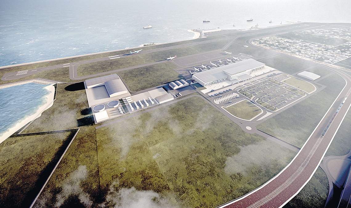
Once the needs and the different development options had been studied, the Master Plan defined the key actions to be taken with regard to each traffic horizon. The most notable actions comprise the extension of the runway over the sea platform, for which Ineco prepared a design in 2021; and the transfer of the commercial traffic operations to the eastern side of the runway, which would involve the construction of new taxiways, apron, terminal building, car parks, access routes and other facilities.
In total, the Plan aims to improve the airport’s operational safety, meet the forecast demand, enable the development of new activities associated with the airport environment, and facilitate the airport’s potential development even beyond the horizons studied in the Master Plan.
In the airfield area, the plan is to extend the runway towards the south, in order to provide an available take-off run of 2,040 metres. This will make it possible to operate flights to JFK using A320 Neo aircraft without compromising the number of passengers. Additionally, the Plan proposes enlarging the runway strip to a width of 150 metres and adding runway end safety areas (RESAs) at both ends, in accordance with Colombian Aeronautical Regulation RAC 14.
To carry out these works, breakwaters and earthworks will be used to reclaim land from the sea and reroute the railway line that runs close to the current airfield. These works are designed to maximise the current capacity of the facilities –in order to accommodate up to 3.2 million passengers per year–and will be carried out within a short strategic time frame, in order to be able to handle the anticipated levels of traffic in the coming years.
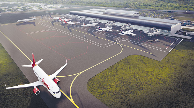
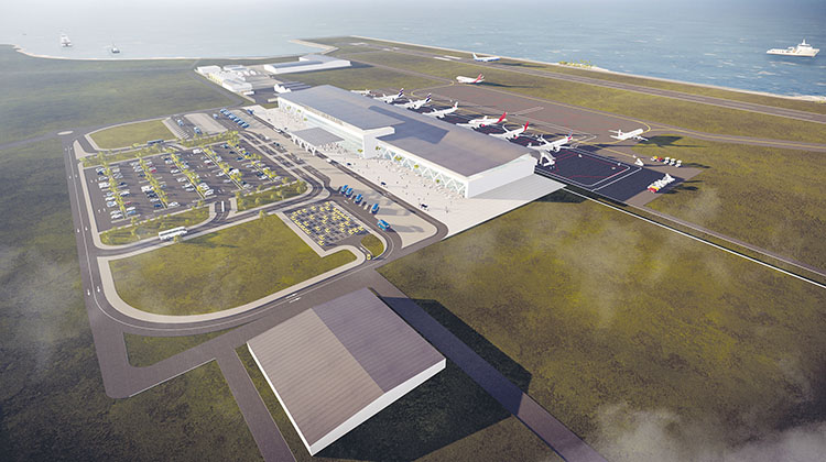
In the medium term, the commercial operations will be moved to the east of the airfield, thereby making it possible to undertake a major expansion of the airport by creating a new apron, terminal building and car parks, in addition to the auxiliary facilities required to enter into operation (rescue and fire-fighting services, power plant, etc.). In the long term, in order to handle 7.3 million passengers it will be necessary to enlarge the apron to provide 13 aircraft parking stands, expand the terminal building to 35,000 m2 and enlarge the various surface-level car parks constructed during the previous stages.
The Plan also provides for new road access from the Troncal del Caribe: this, together with the FENOCO (Ferrocarriles Nacionales de Colombia) railway line will enable the development of an intermodal connection, which is of vital importance to the strategic projects being planned for Santa Marta’s district of cultural, historical and tourist interest.
This intermodal connection will also facilitate the development within the airport of an area for complementary activities (e.g. FBOs, specialist logistics, maintenance and cargo facilities). Land has been set aside for this purpose, in line with the strategic national vision of the country’s civil aviation authority. The current facilities to the west of the runway will be used for general aviation operations (FBOs) or other purposes.
The Master Plan also includes an estimate of the investment required, distributed (approximately) as follows: 35% in the short term, 51% in the medium term, and the remaining 14% in the long term.
Summary of the key works
Airfield
- Move threshold 19 (144 metres) and extend the runway 484 metres to the south, reclaiming land from the sea, to achieve a total TORA of 2,040 metres.
- Enlarge the runway strip to 2,160 x 150 metres.
- RESA of 90 x 80 metres at each end of the runway.
- New runway turning pads and connecting taxiways with a new apron in the eastern area.
Apron, passenger terminal and car parks
- New apron with 13 parking stands for category C aircraft.
- 2,700 m2 of parking space for handling equipment.
- New 35,000 m2 terminal building.
- 530 parking spaces for private vehicles, 100 spaces for taxis and 50 spaces for buses.
Other works
- Reroute the railway line and provide new access.
- Auxiliary facilities: power plant, fuel facilities, loading area, etc.
A legendary city within a sanctuary for birds


With a unique location that combines Caribbean beaches with alpine ecosystems and tropical coastal forests, Santa Marta is one of the most popular tourist destinations for Colombians as well as an increasing number of international visitors.
In addition to its beaches, Santa Marta’s main attractions include Tayrona National Natural Park, which has also been declared a UNESCO Biosphere Reserve. The park is a haven for birds and a popular destination for the country’s growing avitourism (birdwatching) industry. Colombia boasts the world’s greatest diversity of bird life, with over 1,900 recorded species, 70 of which are endemic (the Magdalena region is home to the country’s highest concentration, with 36). Additionally, Colombia boasts 177 species of hummingbird, more than any other country in the world. According to data from the Colombian Ministry of Trade, Industry and Tourism, in the coming years avitourism will be a growth industry, attracting nearly 15,000 foreign visitors, providing 9 million dollars of income and creating more than 7,500 jobs.
In addition to birds, the 383,000-hectare park is home to many other natural treasures, such as the world’s tallest snowcapped coastal mountain, Colombia’s highest peaks (Colón and Bolívar, standing 5,775 and 5,560 metres tall, respectively), and the Lost City Archaeological Park, also known as Teyuna. Teyuna’s ruins are the remains of the ancient capital of the Tayrona civilisation, some 30,000-plus members of which still form part of the region’s indigenous community. The city is known as “Colombia’s Machu Picchu” and is located in the middle of the jungle at an altitude of 900-1,300 metres. It was built around 700 AD on a series of terraces, designed to prevent erosion from the rain. It can only be accessed on foot as part of multi-day guided tours, which are offered by a number of authorised agencies.