
The A-76 highway is one of the first road projects in which the BIM (building information modelling) methodology has been applied, a field in which it is not yet very well developed. This has led to an evolution from two- to three-dimensional models with associated information, and working in a collaborative and digital environment that centralises all of project information and makes it possible to overcome existing constraints in terms of information exchange.
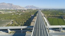
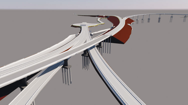
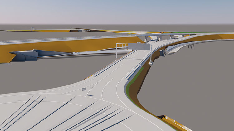
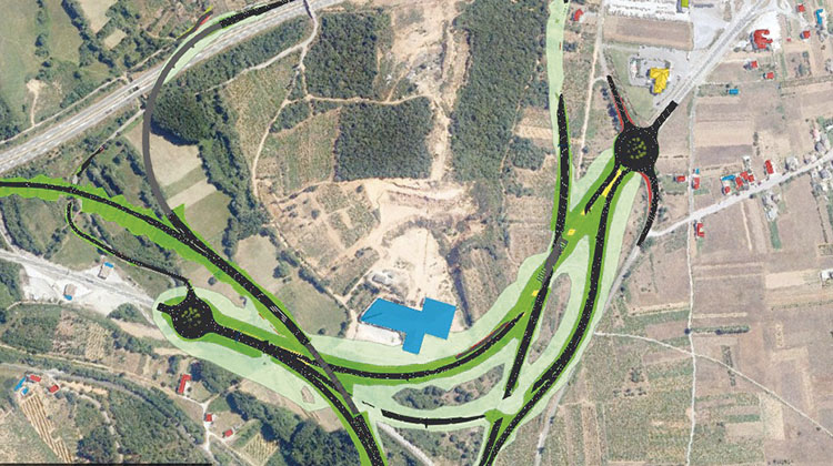
The virtual preconstruction of the first of the slip roads of the Villamartín de la Abadía-Requejo section, that of the future A-76 highway connecting to the A-6 highway, was chosen because it is a good representative case. It is a complex slip road in which the lanes of the A-76 separate to connect to the A-6, allowing all possible movements directly. Its design was determined by the topography of the land; additional carriageways connecting to the N-VI and LE-158/15 roads; and the configuration of the A-6 highway’s existing entries and exits. In terms of its most characteristic features, the project has a total length of over 10 kilometres, requires the construction of 11 structures and involves the channelling of the Arroyo de los Valtuilles.
A 3D model was created with geometric and non-geometric information, put together as a puzzle in which the models provided by the disciplines of layout, road surface, land, drainage, structures, affected services and signalling, signs and defences are added using interoperable formats that allow the integration of digital information from a broad ecosystem of tools with which the aforementioned disciplines work.
A ground-breaking project in Spain
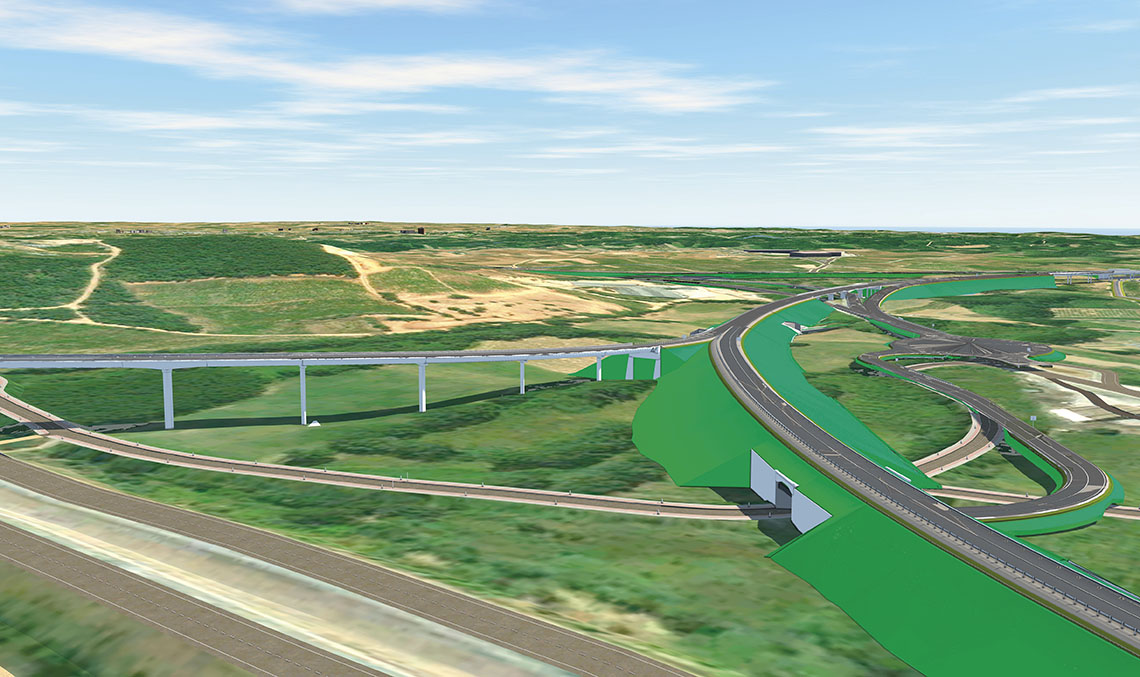
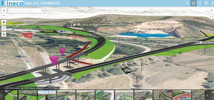
In the A-76 project, the BIM world was connected to geographic information systems, for the first time in Spain and virtually the first time in Europe. What both worlds have in common is that they combine geometric elements associated with alphanumeric data (attributes) and, therefore speak a common language. BIM intrinsically focuses on the three-dimensional model of the infrastructure, and GIS, among other aspects, ensures that all other elements are correctly referenced to real coordinates. But the most important thing is that GIS allows the elements to be related to each other, enabling a multitude of analyses to be performed between the data, based on either spatial (spatial topology) and/or semantic relationships.
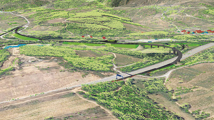
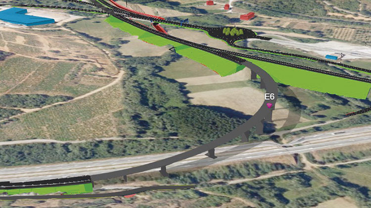
This provides BIM with an endless number of GIS variables (both 2D and 3D) that it did not have previously and which are essential in all phases. GIS has also contributed to facilitating the understanding of the project and its integration into the environment, without limitations of extension and on multiple scales, in the same three-dimensional scenario. This has been the common framework where all of the elements have fitted together: environmental data, results of hydraulic, noise, fauna, expropriation, land registry studies, etc. The scenario become progressively richer as more data has been integrated, all with spatial reference (coordinates), generating a live and virtual model that is being referred to as the ‘digital twin’.
The BIM methodology has been linked to geographic information systems, resulting in living 3D models that are connected to a physical environment, in what is coming to be referred to as geodesign
Accessible thanks to a 3D GIS viewer
All information is accessible through an online 3D GIS viewer. Customers, technicians, collaborators, contractors or interested users can intuitively consult all of the information of the project by scanning a QR code with a mobile phone, or using the URL and an internet connection via mobile, tablet or computer. The display provides easy and intuitive universal accessibility, making it a new tool for decision making, and also a very powerful communication instrument throughout the different phases of the project.
Through this viewer, BIM and GIS democratise and make the project more accessible in a simple, transparent way, and without the need for training or knowledge of the specific software, which will undoubtedly contribute to its implementation in other projects. This accessibility will result in economic and time savings in the transmission of information to the different parties interested in all phases of the design, as well as decision making.
Especially in public investment projects that are of general interest to the public, social consensus is vital from the early stages in order to streamline future administrative procedures. This new behaviour paradigm is consolidated thanks to technological advances, thus generating new mechanisms for public participation.
This report was made possible thanks to special contributions by Miriam Pinilla and Agustín Roldán, civil engineers; Mirela Vladovic, telecommunications engineer; Laura Martín, geographer y Raquel Veneros, technical architect.
BIM-GIS integration enables:
- Enhancement of the BIM model, so that the dataset and 3D models can interact and relate both geometrically and analytically, what is commonly known as topological data analysis. This means that 3D models (IFC files) coexist with all other data models regardless of their origins, as long as they are properly georeferenced.
- Visual and intuitive integration of any kind of data that can be spatially referenced: from engineering models originating from BIM to clouds of LIDAR points, prioritising in the multitude of georeferenced three-dimensional data that is able to coexist within a single scenario, and in turn, in different scenarios simultaneously.
- Refine the model from the planning phase or develop alternatives with LOD2, through to later, more detailed phases in the same GIS environment.
- Application of GIS geospatial analysis tools to feed the BIM model.
- Creation of a digital twin.
This solution achieves the following:
- Improvement of the technical quality of the project and the solution as a whole, by making it possible to see what is not normally seen thanks to the digital twin, which contains all of the disciplines that include construction elements. Being one of the first, if not the first project designed with this technology and at this level in Spain, the project is expected to lay the groundwork for the development of future methodologies and standards that can be shared and implemented in other projects.
- Improved environmental integration of the project.
- Exploration of the potential for the consultation and visualisation of the results through the online 3D GIS viewer for better understanding and consistency of the project.
- Optimisation of coordination between the disciplines involved, by having a common information environment in which all of them coexist. This represents a breakthrough in the use of digital collaboration tools and seeks to overcome existing obstacles regarding the exchange of information between the software of each discipline thanks to the use of interoperable formats.