
Nowadays, air traffic controllers and pilots need to send and receive accurate and reliable information in order to operate safely. To do so, they use communication, navigation and surveillance (CNS) systems. These systems work by transmitting and receiving suitably modulated radio frequency signals that propagate by spatial wave, that is, by direct line of sight between transmitter and receiver, in order to track the position of aircraft and to guide or direct their movement from one point to another in a safe, smooth and efficient manner. The information provided by these systems is therefore essential for the design of flight procedures, which establish the trajectory that aircraft must follow in order to avoid collision with each other or with any element in the environment.
However, the presence of obstacles on the ground in the vicinity of such equipment can cause signal fading or amplification, and, in general, overlaps and distortions in the information transmitted. In recent decades, these effects are becoming more pronounced, as increasing urban and industrial development is taking place in airport environments, leading to the emergence of high obstacle densities in the vicinity of CNS systems.
Automating data entry saves time, improves efficiency and reduces the possibility of human error
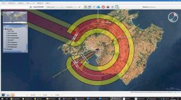
Simulation studies to assess impact on radio systems analyse the disturbances that physical obstacles can cause in radio wave transmission. Their analyses are vital for air navigation because they enable identification of those that are incompatible with the proper functioning and/or performance of the systems, ensuring that aircraft take-off, flight and landing operations are carried out correctly. Ineco boasts a long list of national and international simulation projects to assess effects on CNS radio systems, with more than three thousand studies done.
It is from within this context that the main motivation for this innovation project, developed in 2020, arises. Engineering specialists need software tools to assess the impact of obstacles and terrain on the performance of these systems in a quantitative manner that is as close to reality as possible, enabling them to evaluate key aspects of the design of flight procedures, such as the coverage and signal quality of CNS equipment.
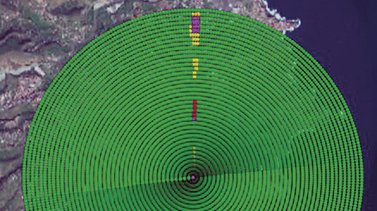
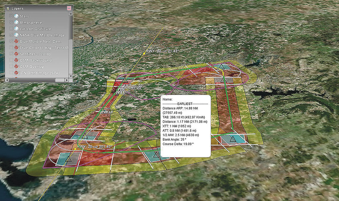
In particular, to assess the impact on pulsed systems, Ineco developed the Impulse tool (currently integrated into Navtools), which, as a first approach to this problem, was capable of carrying out a qualitative analysis of the impact on primary and secondary surveillance radars, and DME equipment.
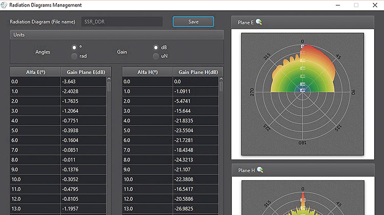
In the new innovation project developed at Ineco, which will have a final version from the first quarter of 2021, a major step forward has been taken by replacing the initial qualitative studies with quantitative studies modelling the real signals emitted by equipment and aircraft for primary and secondary surveillance radars and for DME (Distance Measuring Equipment). In this way, by considering real radiation patterns, encoding and decoding the pulses and taking into account multipath effects caused by terrain and obstacles in the environment, it is possible to carry out much more precise and detailed studies than those carried out so far (qualitative analysis only). New functionalities have also been incorporated in DME stations, such as the calculation of the distance error committed, power losses, system decoupling, etc. The implementation of all these new functionalities makes it possible to address studies that until now could not be undertaken analytically and were resolved qualitatively or by expert judgement. Likewise, having such a powerful tool in air navigation for the study of pulsed systems strongly positions Ineco both in the national and international market when carrying out aeronautical safety studies, radioelectric impact studies or procedure design.